Log in
All resources
Create a design
324 Free Artworks of 17th Century Maps Of France
bibliothèque nationale de france
cartography
chalcography
fondo antiguo
calcografía
cartografía
francia
engraving
grabados
libros del siglo xvii
maps by willem and johannes blaeu
1663 maps of africa
sanson map of the german empire (17th century)
sanson maps of the circles of germany
sanson map of the german empire (17th century)
sanson maps of the circles of germany
sanson map of the german empire (17th century)
sanson maps of the circles of germany
pieter verbiest (ii)
maps from gallica
maps of the course of the rhine by guillaume sanson
bibliothèque nationale de france
maps of the course of the rhine by guillaume sanson
bibliothèque nationale de france
maps by willem and johannes blaeu
17th-century maps of dombes
maps by matthäus merian
baroque
maps by matthäus merian
baroque
old maps of groningen (city)
baroque
history of schwäbisch hall
baroque
17th-century maps of paraguay
1668 maps of south america
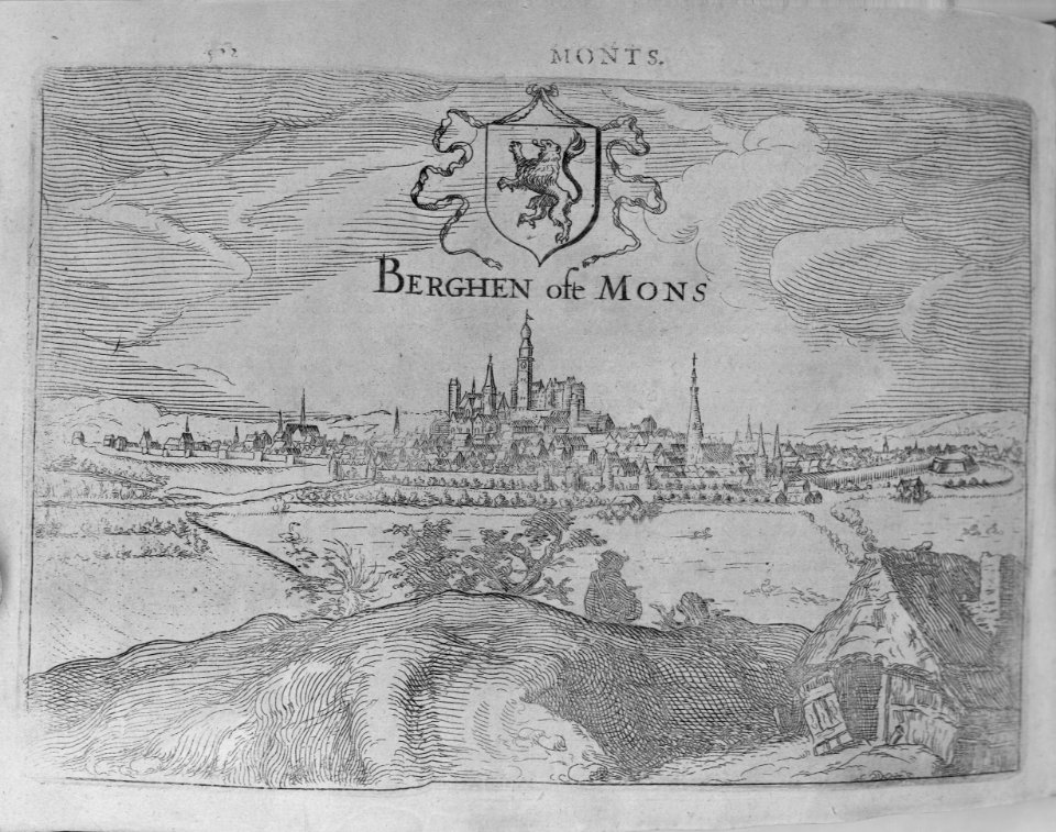
17th-century maps of vienna
maps by nicolaes visscher i
17th-century maps of west africa
1650 maps of africa
maps of île-de-france by françois de la guillotière
bibliothèque nationale de france
17th-century maps of amsterdam
1620s maps of the netherlands
atlas van der hagen (volume 2)
atlas van der hagen
maps of ancient italy by philipp clüver
old maps of the history of liguria
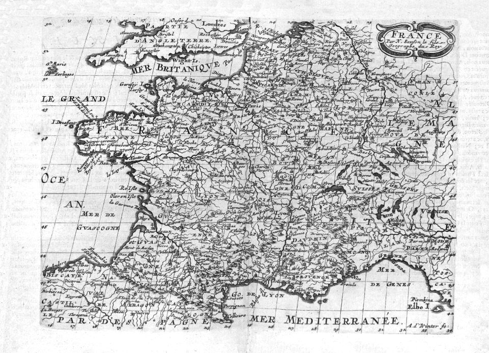
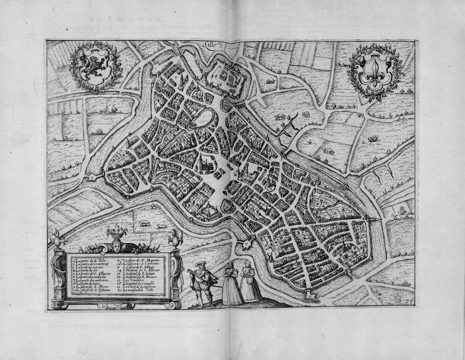
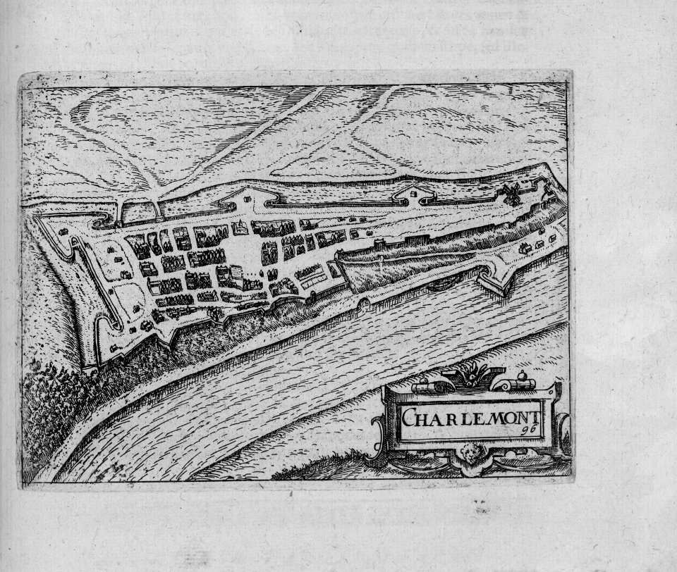
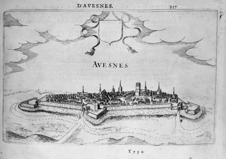
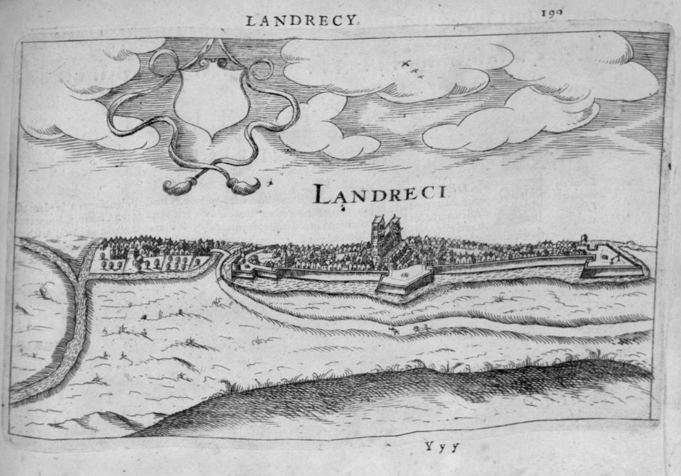
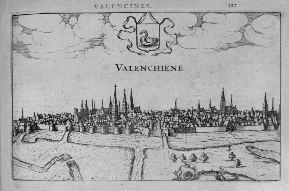
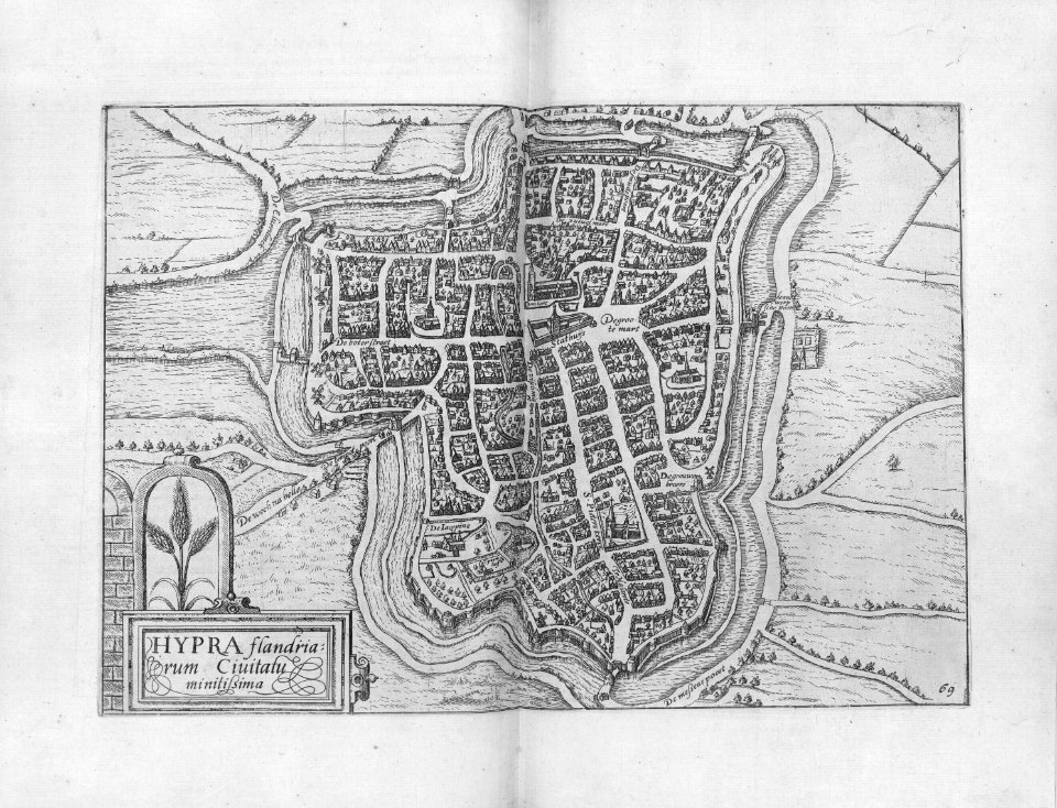
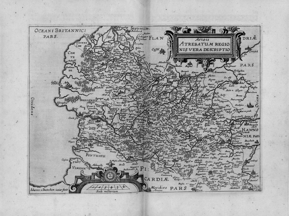
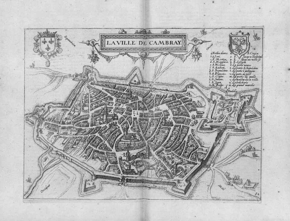
17th-century maps of france
description de l'universe
old maps of utrecht (city)
baroque
maps of rotterdam by berckenrode
baroque
maps of strasbourg in the 17th century
gerard jollain
map of l'evesché du mans by jaillot and cordier
bibliothèque nationale de france
map of l'evesché du mans by jaillot and cordier
bibliothèque nationale de france
france in the 1690s
old maps of france
17th-century maps of transylvania
maps by willem and johannes blaeu
descriptio daciarum (17th-century map)
maps by pieter van der keere
maps by jodocus hondius
maps by john speed
17th-century maps of pembrokeshire
old county maps of pembrokeshire
atlas maior, vol 7 (france i) - joan blaeu, 1667 - bl 114.h(star).7
17th-century maps of xaintonge
maps of barcelona by braun & hogenberg
barcelona in the 17th century
17th-century maps of the strait of magellan
maps by willem and johannes blaeu
maps in the rijksmuseum amsterdam
1627 maps
africa
maps
17th-century maps of the mediterranean sea
portolan charts made in the 17th century
cartography
maps
bibliothèque nationale de france
sanson maps of the holy land
maps by willem and johannes blaeu
17th-century maps of abruzzo
17th-century maps of the holy roman empire
maps by pieter van der keere
reverse sides from gallica
herman padtbrugge
west-indische paskaert (doncker, 1660s)
herman padtbrugge
reverse sides from gallica
herman padtbrugge
reverse sides from gallica
herman padtbrugge
west-indische paskaert (doncker, 1660s)
herman padtbrugge
cartography
maps
maps by pieter van der keere
17th-century maps of czechia
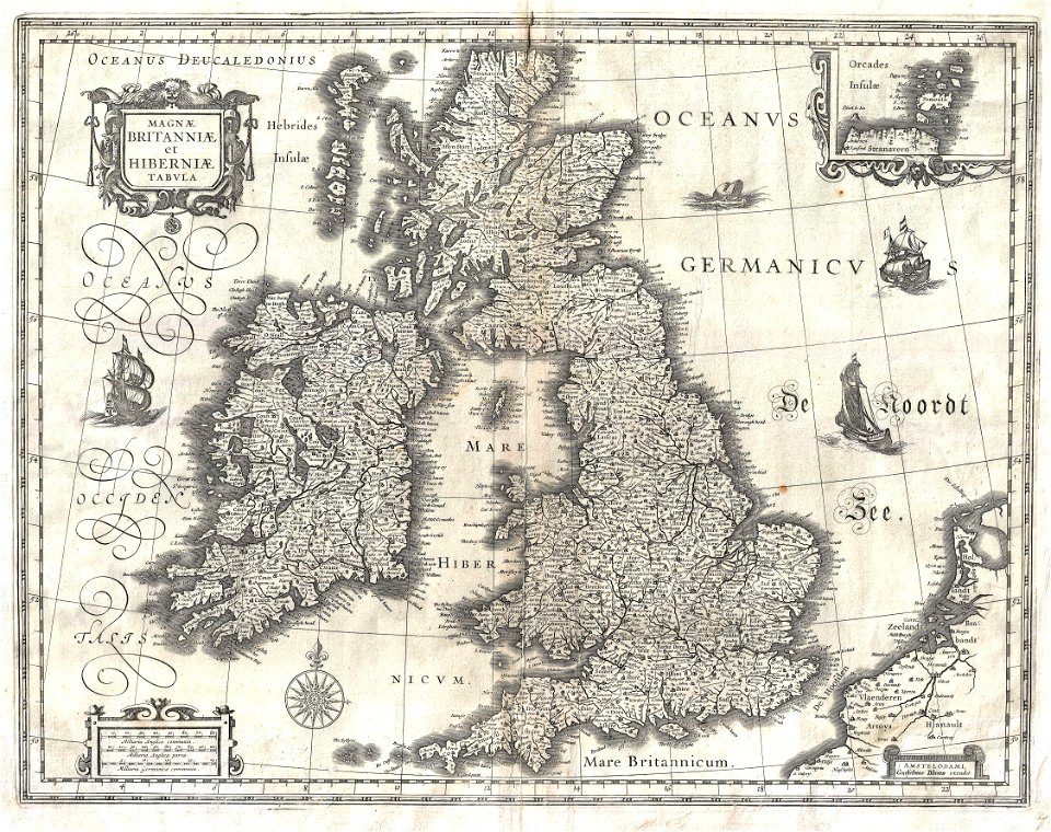
17th-century maps of the british isles
maps by willem and johannes blaeu
maps of provence by pierre-jean de bompar
bibliothèque nationale de france
1600 maps of africa
benjamin wright
17th-century maps of the isle of man
maps by willem and johannes blaeu
cartography
maps
17th-century maps of dordogne
philippe de la rué
toledo, spain in the 17th century
old maps of toledo, spain
cartography
maps
maps of portugal by fernando álvares seco
bibliothèque nationale de france
cartography
maps
cartography
maps
cartography
maps
cartography
maps
cartography
maps
mappe-monde geo-hydrographique (sanson and jaillot, 1674)
cartography of france
maps
city
maps
city
cartography
maps
cartography
maps
maps in the rijksmuseum amsterdam
1627 maps
paraguay, o prov. de rio de la plata cum regionibus adiacentibus tucuman et sta cruz de la sierra - (blaeu) - btv1b8596658x
1640s maps of south america
venezuela, cum parte australi novae andalusiae - btv1b53196851w
17th-century maps of venezuela
17th-century maps of the strait of magellan
1640 maps of south america
philippe de la rué
maps of mysia
maps
city
maps
city
maps
city
maps
city
maps
city
maps
city
cartography
maps
17th-century maps of vienna
bartholomeo camuccio
17th-century maps of vienna
bartholomeo camuccio
philippe de la rué
périgord
17th-century maps of iceland
iceland map by joris carolus
map of ancient asia minor by philippe de la rué
bibliothèque nationale de france
maps of innsbruck by braun & hogenberg
innsbruck in the 17th century
maps
city
cartography
maps
cartography
maps
cartography
maps
cartography
maps
maps
city
17th-century maps of venezuela
johannes leupenius
venezuela cum parte australi novae andalusiae - (willem janszoon blaeu et joan blaeu) - btv1b8596474b
17th-century maps of venezuela
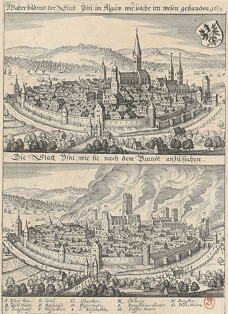
1631 stadtbrand von isny im allgäu
baroque
maps of the islands of greece by marco boschini (1658)
context files from gallica
17th-century maps of pembrokeshire
maps by jodocus hondius ii
maps of algiers by braun & hogenberg
algiers in the 17th century
17th-century maps of egypt
philippe de la rué
maps
sea
maps
sea
maps
sea
201 - 300 of 324
Next page
/ 4

![Aethiopia inferior, vel exterior, partes magis septentrionales, quae hic desiderantur, vide in tabula Aethiopiae superioris / [Joan Blaeu], 1663](https://cdn.creazilla.com/illustrations/10000599277/aethiopia-inferior-vel-exterior-partes-magis-septentrionales-quae-hic-desiderantur-vide-in-tabula-aethiopiae-superioris-joan-blaeu-1663-md.jpg)


![Paraguay taken from the most recent reports / by G[uillaume] Sanson, 1668](https://cdn.creazilla.com/illustrations/10000773533/paraguay-taken-from-the-most-recent-reports-by-g-uillaume-sanson-1668-md.jpg)


![Rotterdam / [M. Merian], Matthäus Merian](https://cdn.creazilla.com/illustrations/10000529192/rotterdam-m-merian-matth-us-merian-md.jpg)


![Venezuela cum parte Australia Novae Andalusiae / [Willem Janszoon Blaeu et Joan Blaeu], Joan Blaeu, between 1638 and 1640](https://cdn.creazilla.com/illustrations/10000255596/venezuela-cum-parte-australia-novae-andalusiae-willem-janszoon-blaeu-et-joan-blaeu-joan-blaeu-between-1638-and-1640-sm.webp)